
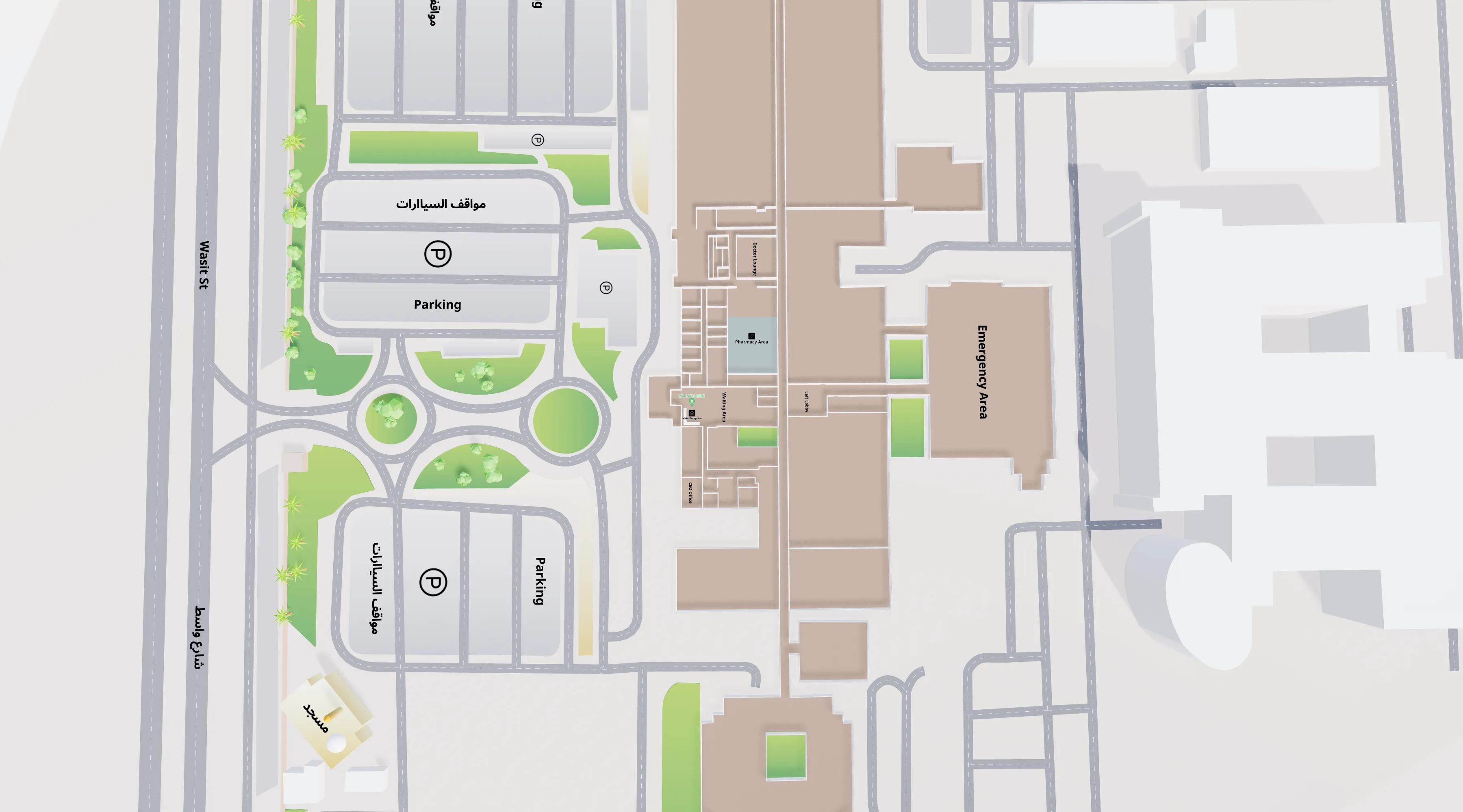
Why buildings are hard to navigate
Almost every large building was designed to be built, not to be understood. Wings get added, departments move, tenants change, and the signage was specified once at handover and never revisited. The result is predictable: around 30% of first-time visitors get lost in large hospitals, and staff at one medical centre spent over 4,500 hours a year giving directions.
The deeper issue is that a sign cannot answer a question. It tells you what is on this floor. It cannot tell you that the clinic moved last month, that the lift is out of service, or which of three corridors is quickest from where you are standing right now. So people ask staff, and staff stop doing their actual job.
What a digital wayfinding system actually contains
"Indoor wayfinding" is often sold as one product. It is really four layers, and knowing which you need is most of the buying decision.
| Layer | What it does | Do you need it? |
|---|---|---|
| The map | A routable digital floor plan, not an architect's drawing. Rooms, corridors, stairs, lifts and the connections between them. | Always. This is the foundation. |
| The destination data | Every room, tenant, department and service someone might search for, with categories, images and opening hours. | Always. This is usually the part venues underestimate. |
| Routing | The path from A to B, including floor changes via lifts, escalators or ramps, and step-free alternatives. | Always. |
| Positioning | The live blue dot showing where the visitor is right now. Needs Bluetooth beacons or Wi-Fi infrastructure for sub-metre accuracy. | Often not. See below. |
The positioning question
This is where budgets get wasted. Several vendors lead with sub-metre positioning accuracy, which requires beacons installed and maintained throughout the building. It is genuinely necessary for asset tracking and some clinical workflows.
For getting a visitor to a clinic, it is usually specification for its own sake. People need to know which floor and which corridor. A QR code at a known fixed point, like a kiosk or a sign, tells the system exactly where the visitor is standing without any hardware at all. Ask what accuracy your use case actually requires before paying for infrastructure.
How the visitor journey works
Arrive
The visitor opens the map from your website, your app, a kiosk in the lobby, or a QR code on existing signage.
Search
They type what they call the place, not its official name. Good search matches x-ray to Radiology and handles spelling variants, including across languages.
Choose
The result shows what they need before setting off: which floor, opening hours, a photo, contact details.
Route
The map draws a path with distance and walking time, changing floors where needed.
Follow
They walk it in 2D for speed, or switch to 3D when the building is unfamiliar and they need to understand how the levels relate.
Hand off
At a kiosk they scan a code and the live route transfers to their phone, so they are not memorising directions.
What it replaces, and what it does not
Compared to static signage
Signage tells visitors where to look. Wayfinding tells them where to go. Signage also cannot be searched, cannot be updated when a tenant moves without a reprint, and cannot say "closed for maintenance."
That said, do not position this as ripping out signage. The two work together, and a proposal that includes removing physical signs is a bigger, slower, more expensive project than it needs to be.
Compared to a PDF floor plan on your website
A static floor plan tells people where things are. It cannot be searched, cannot generate a route, and is out of date the moment something moves. It also fails on a phone, which is where most visitors will open it.
Compared to enterprise GIS
If you already have a GIS team and a spatial data strategy, a platform like Esri ArcGIS Indoors is a reasonable choice and ties indoor space to your wider enterprise datasets. It also needs GIS expertise, significant training and a long deployment.
The question worth asking is who will run this day to day. If the answer is a facilities coordinator or a marketing manager rather than a GIS analyst, enterprise GIS is the wrong tool regardless of what IT already owns. The two can coexist: GIS as the system of record, wayfinding as the visitor-facing layer.
What it costs
Almost no vendor in this category publishes pricing. Most price on the floor area you are mapping, sometimes with a platform fee on top, and contracts run annually or multi-year. Costs that catch people out:
- Content, not mapping
- Writing and maintaining the destination data is ongoing work that needs an owner.
- Positioning hardware
- Beacons have a purchase cost, an installation cost and a battery replacement cycle.
- Kiosk hardware
- Separate from the software, and it needs somewhere to live and someone to clean it.
- Change management
- Whoever owns updates needs the access and the habit, or the map goes stale and stops being trusted.
The honest way to size the benefit is to count how many people ask your staff for directions in a day, multiply by an average interaction, and multiply by your operating days. Most operators have never done that calculation, and it usually settles the question.
When indoor wayfinding is not worth it
Worth saying plainly. A digital wayfinding system is hard to justify if your building is small enough to understand at a glance, if it has a single floor and a clear sightline from the entrance, if visitor volume is low, or if the layout genuinely never changes and existing signage already works.
It pays for itself in buildings that are large, multi-level, frequently reconfigured, or visited mostly by people who have never been there before. Hospitals, airports, malls, campuses and exhibition venues are the obvious cases.
How Mapwise approaches it
Mapwise builds both a 2D and a 3D view from one floor plan, one set of destinations and one routing graph. You edit a store name once and it changes in both views and on every surface: web, iOS, Android and kiosk.
Import starts from .dwg, .pdf, GeoJSON or images, so you begin from the drawings your architect already produced. Search runs in English and Arabic with native right-to-left support. Routing handles floor changes via lifts, escalators and ramps, with a dedicated accessibility mode for reduced mobility.
Ready to compare vendors? Read how to choose indoor wayfinding software, which sets out the eight criteria that matter and the questions vendors avoid. For the 2D and 3D question specifically, see 2D and 3D indoor maps. For your building type, see indoor wayfinding by venue type, or browse the full platform.