


Find your way inside.
Mapwise turns your floor plans into interactive indoor maps. Visitors search for where they need to go and follow a route across every floor, in 2D or 3D.


Same map, same points of interest.Open the live map
Deployed at
- Iso Omena
- Stamford Hospital
- Hamad International Airport
- Orange Business Services
- 2Mm²
- Mapped at a single airport
- Hamad International, Doha
- 30M+
- Passengers guided a year
- 4
- Surfaces from one map
- Web, iOS, Android, kiosk
- EN + AR
- Bilingual, with native RTL
People do not get lost because buildings are badly designed. They get lost because a floor plan on a wall cannot answer a question.
A sign tells you what is on this floor. It cannot tell you that the clinic you want moved last month, that the lift is out, or which of three corridors gets you there fastest. So people ask staff.
- 30%
- of first-time visitors get lost in large hospitals
- 4,500
- staff hours a year spent giving directions at one medical centre
Sources: Gozio Health, citing a study at Emory University Hospital.
2D and 3D indoor maps from one floor plan
Most platforms make you choose, or charge you twice. Mapwise builds both from the same floor plan, the same points of interest, and the same routes. Your visitors switch whenever they want.
2D
Fast, clear, and readable at a glance. This is the mode that gets someone to a toilet in eight seconds. Best for kiosks, directories, accessibility, and anyone in a hurry.
3D
Shows the building the way people experience it. Floors stack and landmarks appear where they actually are. Best for large or unfamiliar venues where orientation is the real problem.
Edit a store name in 2D and it changes in 3D. There is only one map.
Everything a visitor needs to find their way.
High-fidelity 3D visualisation
Immersive rendering of complex environments with realistic textures and lighting, and dynamic level of detail so it stays smooth on any device.
Bilingual search in English and Arabic
Predictive search with native right-to-left support, so a visitor finds a destination by the name they actually use. Results carry images and descriptions, not just a pin.
Multi-floor pathfinding
Routes that move between floors using lifts, escalators and ramps, with a dedicated accessibility mode for people with reduced mobility.
QR handoff from kiosk to phone
A visitor scans the kiosk and the live route transfers to their phone browser. No app download.
Web, iOS, Android and kiosk
Native support across all four, with a touch-optimised interface and offline capability on mobile.
Interactive 2D and 3D editor
Design buildings from map elements like walls and floors rather than a single static file, so a layout change is an edit and not a redraw.
Import from .dwg, .pdf and GeoJSON
Start from the drawings your architect already gave you. Images are supported too, and maps export in multiple formats.
Themes and branding
Switch between visual identities including light, dark and corporate, and match the map to the venue brand.
Behavioural analytics
A dashboard covering map loads, search trends and high-traffic corridors, so you can see what visitors look for and where they actually go.
API-first
JWT-based API keys and an OpenAPI architecture, for integration with facilities management, IWMS or IoT systems.
Case study
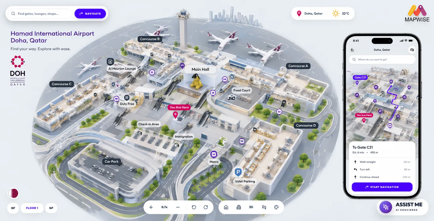
Hamad International Airport
Connectiv is a long-standing partner who contributed to the success of our airport mobile application. The service allows travellers to be guided from check-in to boarding while enjoying a visit to our stores.
- 30M+
- Passengers a year
- 2Mm²
- Total mapped area
Indoor wayfinding for every kind of venue
The platform is the same everywhere. What changes is the hard part: tenant churn in a mall, an appointment letter in a hospital, a connection time in an airport. Compare all five venue types, or start with the one that looks like yours.
Shopping malls and retail
Shoppers find the store, the tenant gets the footfall, and your information desk stops being a directions desk.
Hospitals and healthcare
Patients search by department, clinic or the wording on their appointment letter, then follow a route from the right car park to the right door.
Airports
Passengers search for a gate, a lounge or a retailer and follow a route with walking time, so they arrive with time left to spend on the way.
Corporate campuses
Visitors get a link with their meeting invitation that routes them to the room, so reception stops walking people to meeting rooms.
Exhibitions and events
Delegates find the stand, the session and the hall without a printed board, and the map changes with every event.
Frequently asked questions
- What is indoor wayfinding?
- Indoor wayfinding is how people find their way inside a building. Digital indoor wayfinding replaces static signs and printed floor plans with an interactive map that visitors can search, so they get a route to a specific destination instead of a general sense of direction.
- How is this different from a floor plan on our website?
- A floor plan shows where things are. It cannot be searched, it cannot generate a route, and it is out of date the moment a tenant moves. A Mapwise map is searchable, gives directions across floors, and updates everywhere at once.
- Do visitors need to download an app?
- No. A visitor can scan a QR code at a kiosk and the live route transfers straight to their phone browser. Mapwise also runs inside your own iOS and Android apps if you have them.
- What file formats can you work from?
- Mapwise imports .dwg, .pdf, GeoJSON and images, so you can start from the drawings your architect already produced. Maps export in multiple formats.
- Does it work in Arabic?
- Yes. Search does predictive matching in English and Arabic with native right-to-left support, and 3D labels rotate to face the camera so Arabic text stays readable at any viewing angle.
- Does it replace our GIS?
- No, and it is not trying to. If you have a GIS team and a spatial data strategy, keep it. Mapwise is the visitor-facing layer: search, routing, and a map people actually use to get somewhere.
See it running in your building.
Send us one floor plan. We will build a working map of your space and walk you through it. No commitment.