
Buildings nobody designed to be found in
The UK problem is not scale, it is history. A district general hospital that opened in the 1890s and has been extended in eight phases since. A university with departments in fourteen buildings across a city centre rather than on one campus. A shopping centre built in the 1970s, re-clad twice, with a level numbering scheme that only makes sense to the people who work there.
Signage was added to those buildings one phase at a time, by different people, to different standards. It tells you where the wing is. It does not tell you where the clinic named on your appointment letter is, because the letter and the sign were written by different departments a decade apart.
Accessibility is a duty, not a feature
In most markets a supplier can sell accessible routing as a differentiator. In the UK it is closer to a floor. Service providers owe a duty to make reasonable adjustments under the Equality Act 2010, and public sector bodies, which covers most NHS trusts, councils and universities, additionally have to meet the accessibility standard set out in the 2018 regulations and publish a statement saying how far they do. A public-facing wayfinding app or web map usually sits inside that scope.
What that means for an evaluation, in practice:
- Step-free routing as a route type
- A wheelchair user asks for the same destination and gets a different route, using lifts and ramps rather than the stairs the default route would take.
- One map, not a separate accessible version
- A parallel accessible site is the thing that goes stale first, because nobody remembers to update it when a department moves.
- Kiosk height and reach are a siting decision
- Software cannot fix a screen mounted above a seated eye line. Agree the mounting height with whoever installs it, before the order goes in.
- An accessibility statement you can publish
- The regulations expect one. Ask every supplier for theirs during evaluation. A vendor who cannot produce it during a sale will not produce it after one.
Ask for the accessibility statement while you are still choosing. It is the cheapest question on the list and it narrows a shortlist faster than a feature matrix does.
A second language should be a content job
If you operate in Wales, Welsh Language Standards mean Welsh is not a translation you add at the end, it is a service you provide on equal terms. Scottish public bodies can carry Gaelic commitments of their own. Most indoor mapping platforms treat a second language as a language pack, and that holds right up until a label has to render inside a 3D scene or an interface has to mirror.
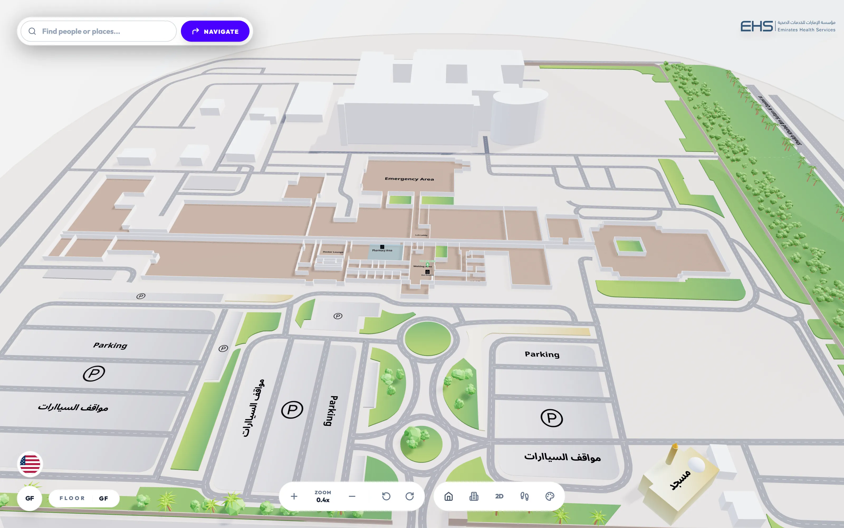
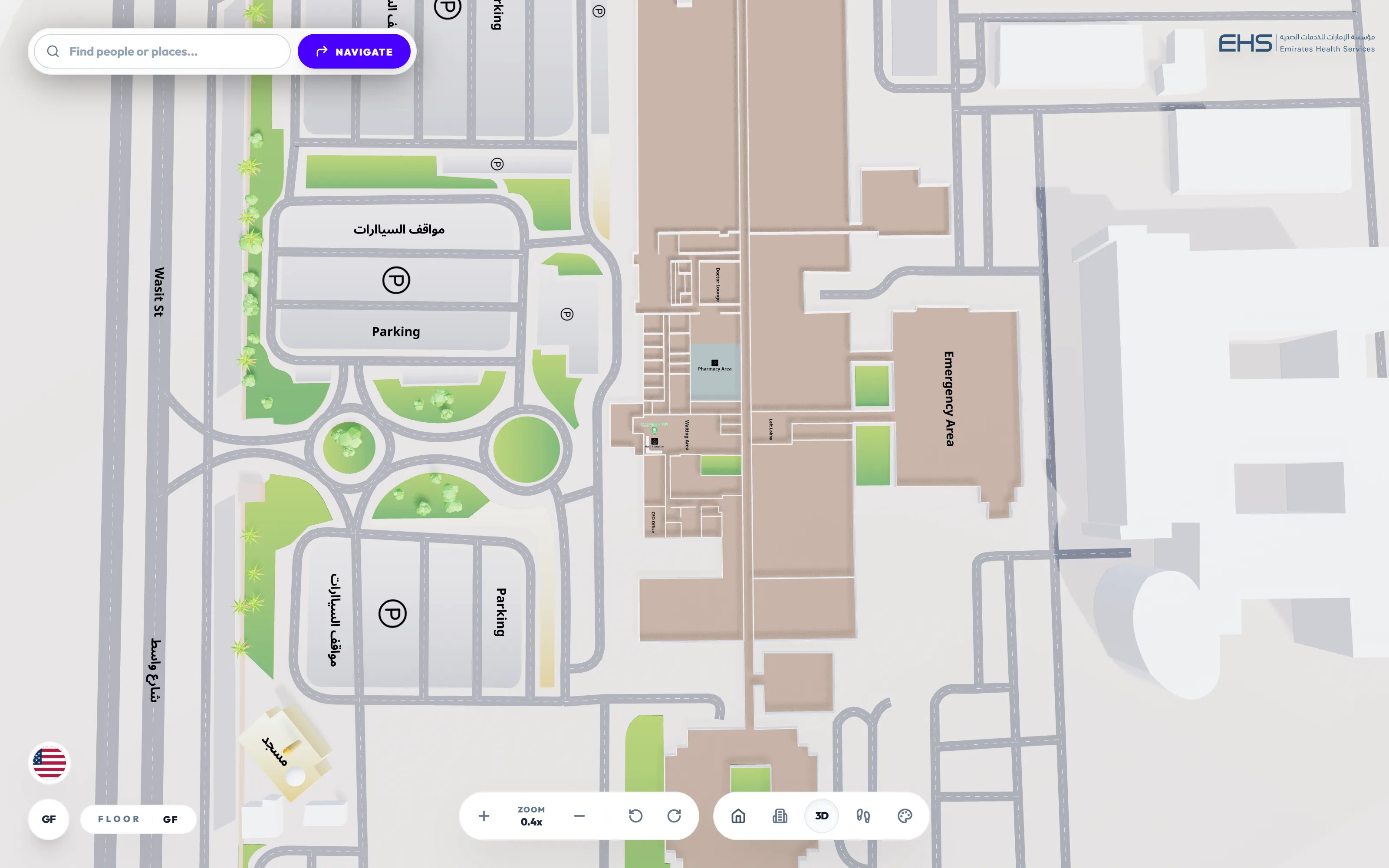
Our evidence for this is not a UK venue, it is a harder case. Al Qasimi Hospital, mapped for Emirates Health Services, renders English and Arabic labels into the map itself rather than into an interface layer sitting on top of it. Arabic letterforms connect, so they lose legibility under distortion far faster than Latin script does. Switch between the two views and watch the labelling hold.
 Design in progress
Same map, same points of interest.
A renderer that survives that has no difficulty with Welsh. The engineering underneath is language-agnostic, which is the whole point: the work becomes writing the content, not rebuilding the map.
Where this matters
The venues where somebody arrives once, needs one specific place, and has no mental model of the building.
NHS trusts and hospitals
Estates extended in stages over a century, where the letter names a clinic, the signs name a wing, and the patient has never been on site before. Routing runs from the right car park to the right department, with a step-free option.
Shopping centres and retail parks
Multi-level centres with regular tenant churn. A shopper searches the brand they know, gets the unit and the right lift, and the centre team edits a tenant change once instead of reprinting boards.
Universities and colleges
Departments spread across a city rather than sitting on one campus, and a freshers fortnight that produces several thousand lost people at once. Routes cross between buildings and between indoor and outdoor space.
Airports and stations
We know this one. Mapwise covers two million square metres at Hamad International, guiding over 30 million passengers a year from check-in to boarding.
Stadiums, arenas and event venues
Everyone arrives inside the same ninety minutes and each needs a specific block, gate or concourse. The layout changes by event, which is a content edit rather than a remap.
Offices and corporate estates
Hybrid working turned regular staff back into visitors. Somebody in the building two days a week needs the room, the desk and the facilities without asking reception.
What it looks like running
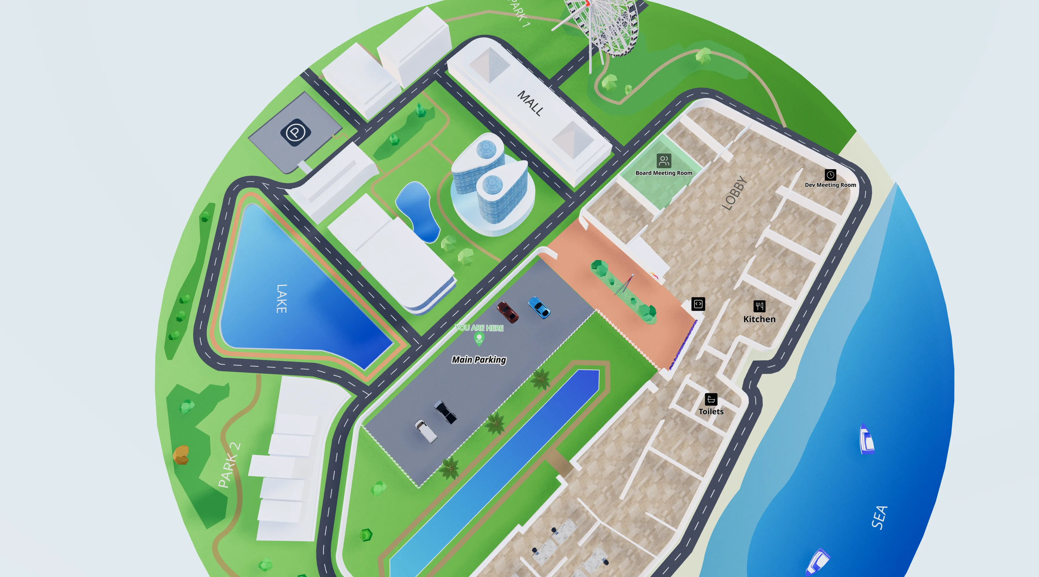
A sample mixed-use estate with offices, a mall, parking, parks and a waterfront, which covers most of the venue types above in a single map. Search a destination, follow the route, switch between 2D and 3D. It is the live product rather than a video of it.
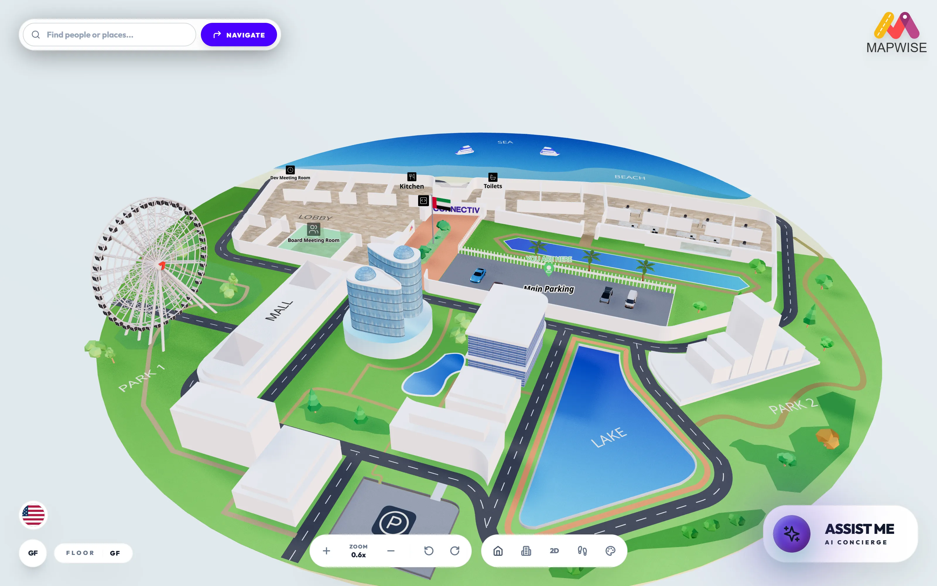
Loads the live map. Search, route, and switch between 2D and 3D.
What deployment looks like
Five steps, and the third one takes longest. Nobody expects that at the start of a project and everybody discovers it in the middle of one.
Send us floor plans
DWG, PDF, GeoJSON or images. Whatever the estates team already holds, however old it is.
We build the map
Rooms, corridors, stairs, lifts and the routes between them, in 2D and 3D from the same source.
You add the content
Names, departments, opening hours, images and contact details. This is the step venues underestimate, and the one that decides whether visitors find anything.
Publish
Web, iOS, Android and kiosk at once, plus QR codes on the signage and printed material you already have.
Keep it current
A department moves, you edit once, and every surface updates. Agree who owns that before go-live rather than after it.
Buying it
Three questions decide most UK evaluations, and all three are cheaper to ask now than to discover during implementation. Where the data sits, and whether UK residency is a legal requirement for you or an information governance preference. Whether you are buying through a framework, and which one, because that shapes the paperwork far more than the product does. And who internally will own the content after go-live, because a map nobody updates ends up worse than no map, having taught people to trust it first.
If you are still comparing platforms, the buyer guide sets out eight criteria and how the main platforms in this category, including the UK and European ones, compare against them. It also says plainly where we are not the right answer.
Support and delivery
Support runs three to four hours ahead of London, so a question sent at nine in the morning is answered before lunch rather than after your afternoon. Several of the comparable platforms are supported from North America, where your morning is their night.
The reference deployment is a genuinely hard one too: two million square metres of airport, serving over 30 million passengers a year, a larger and more punishing estate than almost any UK venue would put in front of us. Mapwise is built by Connectiv rather than a British company, and we would rather you knew that from this page than find it out during due diligence. Judge us on who answers when a kiosk goes down on a Tuesday, not on where the head office sits.
Getting started
Send one floor plan. We will build a working map of that space and walk you through it before you commit to anything. Starting with a single building, or even a single floor, is the fastest way to prove the workflow and to find out who internally is going to own keeping it current.
New to the category? Indoor wayfinding explained covers the fundamentals, and 3D indoor maps covers when the third dimension earns its place and when it does not. Evaluating for a specific venue type, see hospital wayfinding, mall wayfinding, or all five venue types. Or browse the full platform and the team behind Mapwise.