
Airport wayfinding that gets passengers to the gate
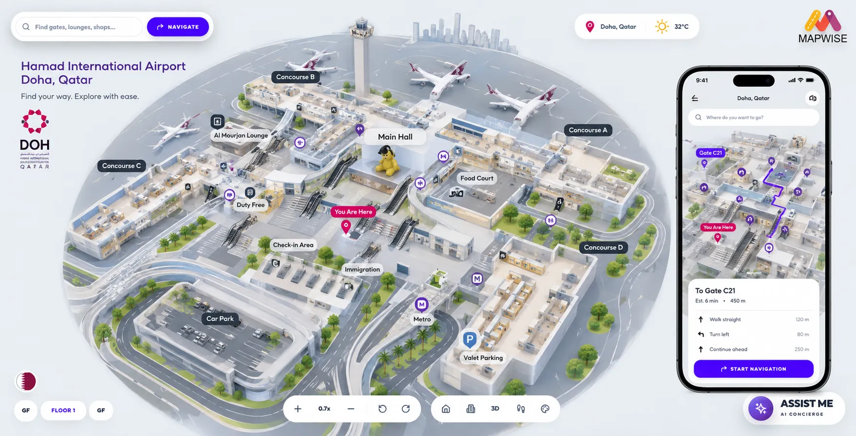
Passengers search for a gate, a lounge or a retailer and follow a route with walking time, so they arrive with time left to spend on the way.
Timely departures
The quickest route to the gate, accounting for accessibility needs. Fewer lost passengers and fewer delayed boardings.
Reinforce safety
Accurate indoor data for security teams, with emergency exits and evacuation routes clearly marked.
Drive loyalty and revenue
Push duty-free offers and click-and-collect points along the route, which is where non-aeronautical revenue comes from.
Who gets lost, and what it costs
Transfer passengers with a short connection, first-time flyers, and anyone whose gate has changed since they cleared security. All of them are working against a clock, and none of them will browse the shops until they know they are going to make the flight.
- Late-to-gate passengers delay boarding
- And a delayed departure is expensive in a way that is measured, reported, and attributed to somebody.
- Anxious passengers do not spend
- Non-aeronautical revenue is a large share of the income of an airport, and it depends on passengers feeling they have time in hand. Uncertainty about the gate removes that feeling.
- Roaming staff and information desks
- Are the current answer to a wayfinding problem, and they are among the most expensive answers available.
- Terminal changes outpace the signage
- Retail units, security layouts and gate allocations move faster than physical signs can be replaced.
Deployed at
Hamad International Airport
Connectiv is a long-standing partner who contributed to the success of our airport mobile application. The service allows travellers to be guided from check-in to boarding while enjoying a visit to our stores.
- 30M+
- Passengers a year
- 2Mm²
- Total mapped area
What changes
- Search for a gate, a lounge, a retailer or a prayer room
- In English or Arabic, matching what the passenger types rather than the official designation printed on the sign.
- Routes carry walking time
- A passenger who is told the gate is nine minutes away knows they have twenty minutes to spend. That is the entire commercial mechanism, in one line.
- Multi-terminal and multi-level routing
- Including the transfers between them, so a connection is one continuous route rather than three separate maps.
- One map on every surface
- Kiosks in the terminal, the airport website, the airport app, and a QR handoff that moves a live route from a kiosk to a phone.
Powerful tools for complex spaces
Asset tracking
Monitor baggage carts, ground support equipment and cargo containers in real time to optimise deployment.
Easy map drawing
Update terminal maps with simple 2D shapes and tools, without redrawing the whole layout.
3D models library
Ready-to-use 3D models built for airport environments.
Format flexibility
Import from .dwg, .pdf or GeoJSON. Export in multiple formats to suit your operations.
Multi-device deploy
Publish across kiosks, websites and native iOS and Android apps at once.
Access control
Separate access levels for staff and passengers, so sensitive infrastructure data stays protected.
Common questions
- How large a terminal can this handle?
- Mapwise covers two million square metres at Hamad International Airport in Doha, serving over 30 million passengers a year. Scale is not the open question in an airport conversation; integration usually is.
- Can the map react to a gate change?
- That depends on integration with your flight information system, and it is the right thing to scope in the first technical call rather than assume. Tell us which system you run and we will be specific about what connects and what does not.
- What about security and restricted areas?
- Access control is by profile, so staff and passengers see different things from the same map. Airside infrastructure that should not be public does not appear in the passenger view.
- Do passengers need to install an app?
- No. The map runs in the browser from a QR code on existing signage, on kiosks in the terminal, and inside your own app if you have one.
Read next
How indoor wayfinding works
What a wayfinding system contains, what it replaces, what it costs, and when it is not worth doing.
2D and 3D indoor maps
When three dimensions help a visitor, when they get in the way, and how to offer both.
Indoor wayfinding in the UAE
Bilingual maps for Emirates venues, delivered from our Dubai innovation centre.
Ready to upgrade your terminal?
Send us one floor plan. We will build a working map of your space and walk you through it.