
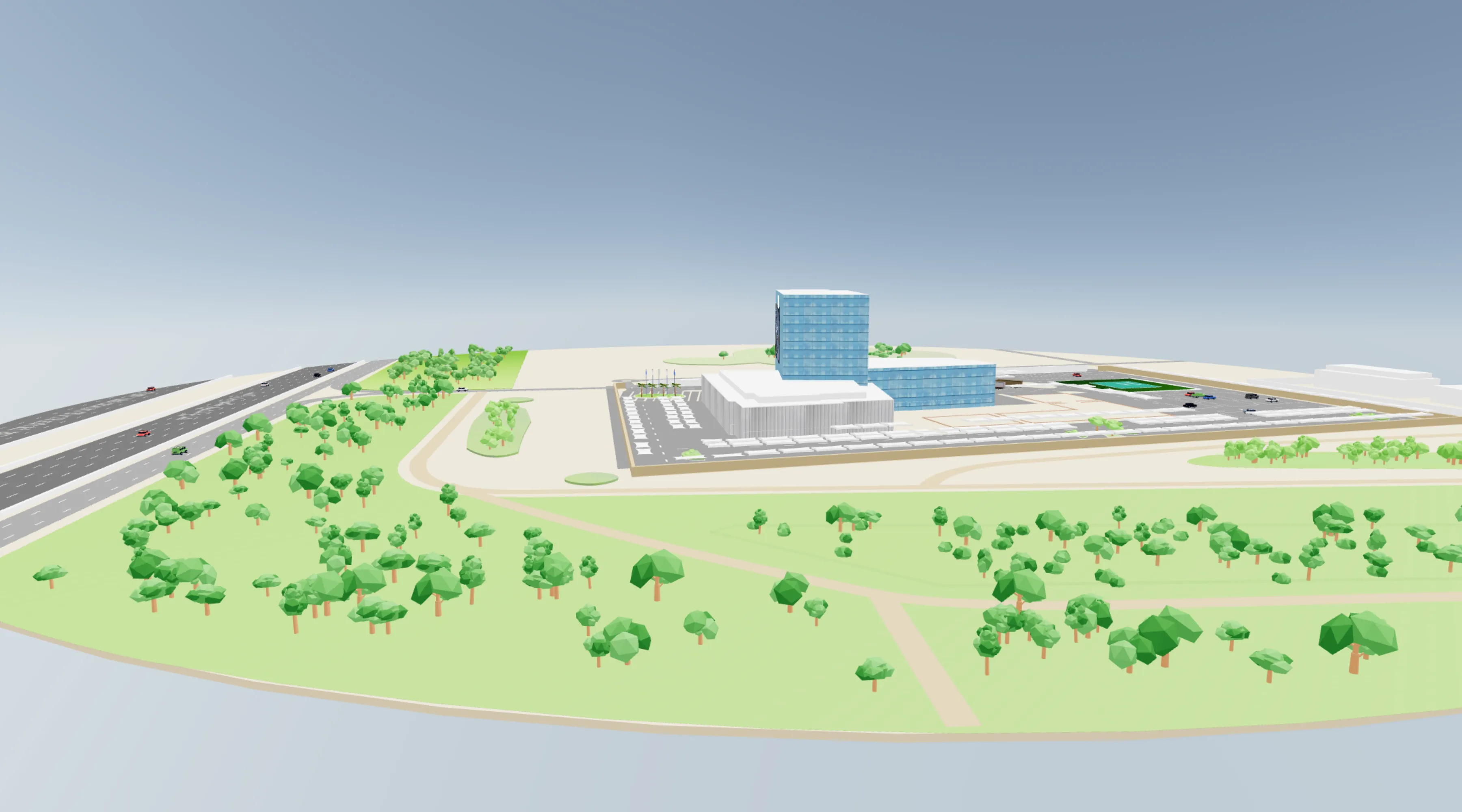
What a 3D indoor map is
A 2D indoor map is a plan view: you look straight down, and the building is a set of shapes and labels. A 3D indoor map renders the same space as a model you can rotate and tilt. Floors stack above one another, walls have height, and recognisable landmarks appear where they actually are.
That difference matters for one specific reason. Reading a plan view requires you to translate a symbol into the space in front of you, and a lot of people find that hard. Seeing the atrium you are standing in, rendered as the atrium, removes that translation step.
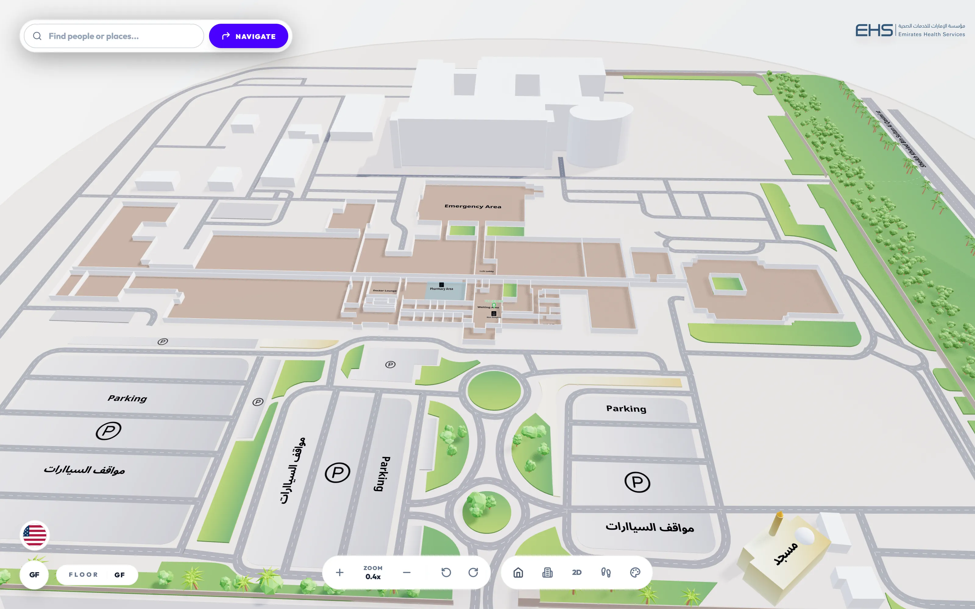
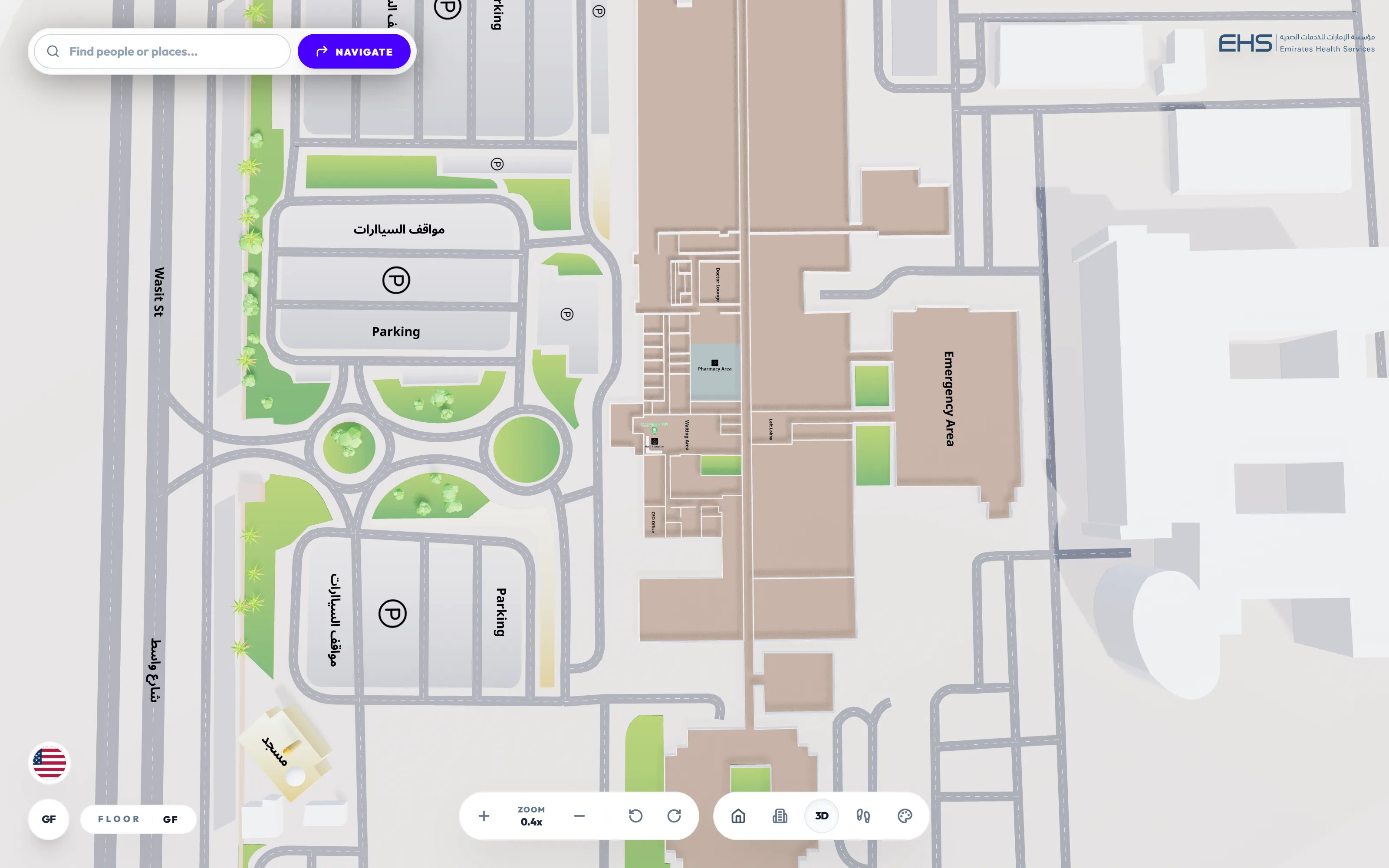 Design in progress
Same map, same points of interest.
When 3D genuinely helps
- Multi-level spaces with open atriums
- Malls and airports are the clearest case. In a plan view, "the level above, across the void" is very hard to convey. In 3D it is obvious.
- First-time visitors
- Someone who already knows the building wants speed. Someone who has never been wants to understand the shape of it.
- Buildings where the architecture is the brand
- Resorts, flagship retail and landmark venues. The map is marketing collateral as much as a utility.
- Explaining a route before it starts
- A 3D fly-through of the path from entrance to gate does more than a list of turns.
- Winning the room in a demo
- Worth being honest about this. 3D is what makes people say yes in a meeting, even when 2D is what they use daily.
When 3D gets in the way
Any vendor who will not tell you this is selling, not advising.
- Quick lookups
- If someone wants the nearest toilet, a flat map answers in about eight seconds. Rotating a 3D model does not.
- Kiosks with queues
- A kiosk in a busy concourse needs to be readable by someone standing behind the person using it. 2D wins.
- Accessibility
- A tilted, rotatable, perspective-distorted view is harder for people with low vision or cognitive impairments. There must always be a 2D and a text path.
- Low-end devices and poor connectivity
- A 3D engine is a large download. On a mid-range phone over congested venue Wi-Fi, insisting on 3D means a blank screen.
- Single-floor, simple buildings
- If the layout is legible from the door, 3D is decoration.
2D and 3D compared
| 2D | 3D | |
|---|---|---|
| Best at | Speed, clarity, quick lookups | Orientation, understanding the building |
| Ideal surface | Kiosk, directory, mobile in a hurry | Web, marketing, pre-visit planning |
| Accessibility | Stronger. Simpler to read and describe. | Weaker. Needs a 2D fallback. |
| Load cost | Very low | High, unless loaded on demand |
| Demo impact | Modest | High |
The rule: one map, two views
The mistake is treating these as two products. If your 3D map is a separate build, it drifts out of sync with the 2D one, costs twice as much to maintain, and eventually somebody updates a tenant in one and forgets the other.
Mapwise builds both from a single source: one floor plan, one set of points of interest, one routing graph. Change a store name and it changes in both views and on every surface. When a visitor switches modes, the destination they selected and the route drawn stay exactly where they were.
Making 3D fast
The most common way a 3D map fails is performance. A WebGL engine plus geometry can run to hundreds of kilobytes or more, and if it sits in the critical path the page is blank while it downloads.
Three things fix it:
Load 2D first
The default view should be plain, fast and require no 3D engine at all. Fetch the engine only when someone presses the 3D toggle.
Optimise the geometry
Mapwise uses a proprietary binary format that cuts map data overhead by around 90%, plus dynamic level of detail so distant geometry renders simply.
Reserve the space
The map container should hold its dimensions, so switching views does not shift the page around the visitor.
The map at the top of our homepage follows all three. The 2D view is plain HTML that needs no JavaScript, and the 3D engine downloads only if you press 3D.
Labels, angles and Arabic
A detail that sounds small and is not. In a plan view, text sits flat and reads normally. Tilt into 3D and naive label rendering skews the text with the surface, which at a shallow angle makes it unreadable.
Mapwise billboards its labels: text and icons rotate to face the camera regardless of the viewing angle. This matters for every language and it matters more for Arabic, where letterforms connect and distortion degrades legibility faster. It is the mechanism that makes a genuinely bilingual 3D map possible rather than a 3D map with Arabic bolted on.
Try it
This is a live Mapwise map, not a video. Search a destination, follow a route, and use the control bar to switch between 2D and 3D yourself.
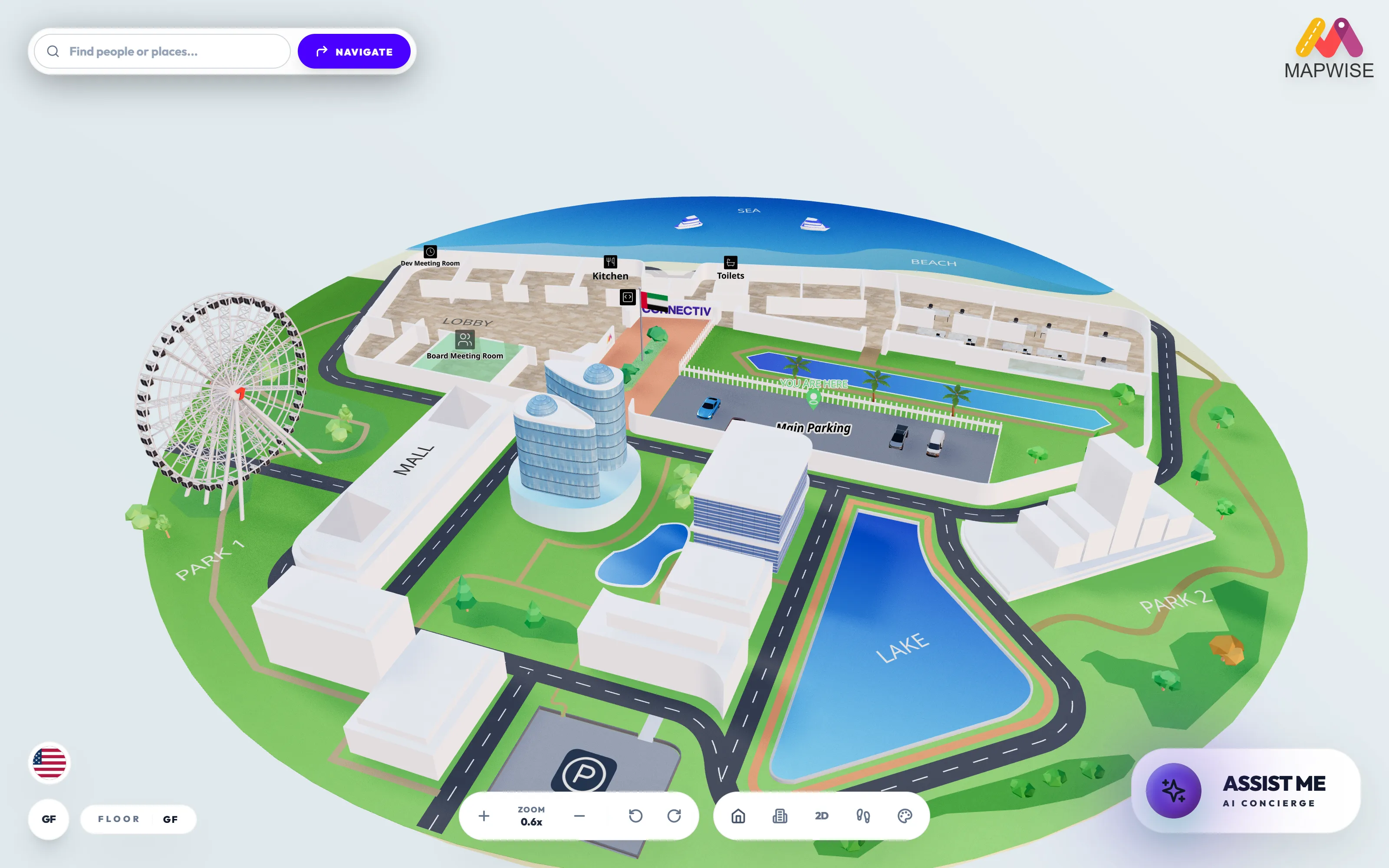
Loads the live map. Search, route, and switch between 2D and 3D.
Start with indoor wayfinding explained for the fundamentals, or how to choose indoor wayfinding software if you are already comparing vendors. More capability detail in the full platform.